-40%
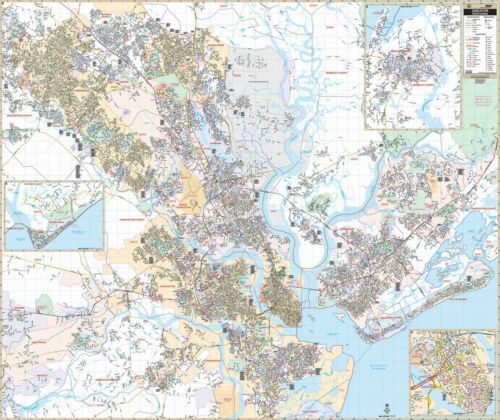
Charleston, SC Wall Map
$ 102.93
- Description
- Size Guide
Description
Charleston, SC Wall MapCharleston, SC Wall Map
The Charleston, South Carolina Wall Map by Kappa Map Group measures 67" W x 56" H and provides indexing in a separate book. Up-to-date cartography with new streets and changes along with complete street detail at a scale of 1"=2500'. Printed in color and laminated making the map both markable and washable.
The area of coverage ranges: North: to include Goose Creek and Summerville; South: to include the Charleston Executive Airport; East: to include all of the Isle of Palms and the City of Mount Pleasant; West: to include all of Summerville and portions of Ravenel and Meggett. insets are as follows: Moncks Corner, Edisto Beach, and Downtown Charleston showing points of interest.
The special features and data include: all streets and highways, government buildings, airports, block numbers, subdivisions, libraries, golf courses/country clubs, railroads, ZIP codes/boundaries, shopping centers, water features, recreational parks, cemeteries, educational facilities, hospitals, post offices, city limits and annexations, fire and police stations, and miscellaneous points of interest.
Framing rails are included on top and bottom for easy wall mounting. Railed wall maps can be turned into pull down maps on spring rollers for an additional .
Year: 2015
Edition: 2nd
